 Flybound
 General aviation · Day-trip triage
Where to,
today?
Every airport in day-trip range of your home field — scored GO, CAUTION, or NO-GO against live weather, the weather along your route, your fuel, your airplane, your minimums, and getting home before dark. One glance. One map.
Planning aid — not for navigation. Always verify with an official briefing (FAR 91.103).
A flyable morning, lost to tab-juggling.
Flying purely for the joy of the destination (a likely burger and new place exploration) is general aviation's favorite mission and its least-served piece of software. The usual workflow for “where should we fly Saturday?” is METARs in one app, TAFs in another, winds aloft on a third, fuel math on paper, a guess at sunset — then you pick a field from memory.
Electronic flight bags assume you already know where you're going. They're built to fly a trip you've chosen, not to help you choose one. Nobody owns the decision before the flight plan. Flybound does.
- ①The destination can be VFR while a layer of IFR sits across the middle of your route.
- ②“Home before dark” is a different question from “legal to land at night with passengers.”
- ③A field can be in range on fuel — but only with a stop you didn't plan for.
Three taps from “maybe” to wheels-up.
Set it up once. After that it's a thirty-second glance before every flyable weekend.
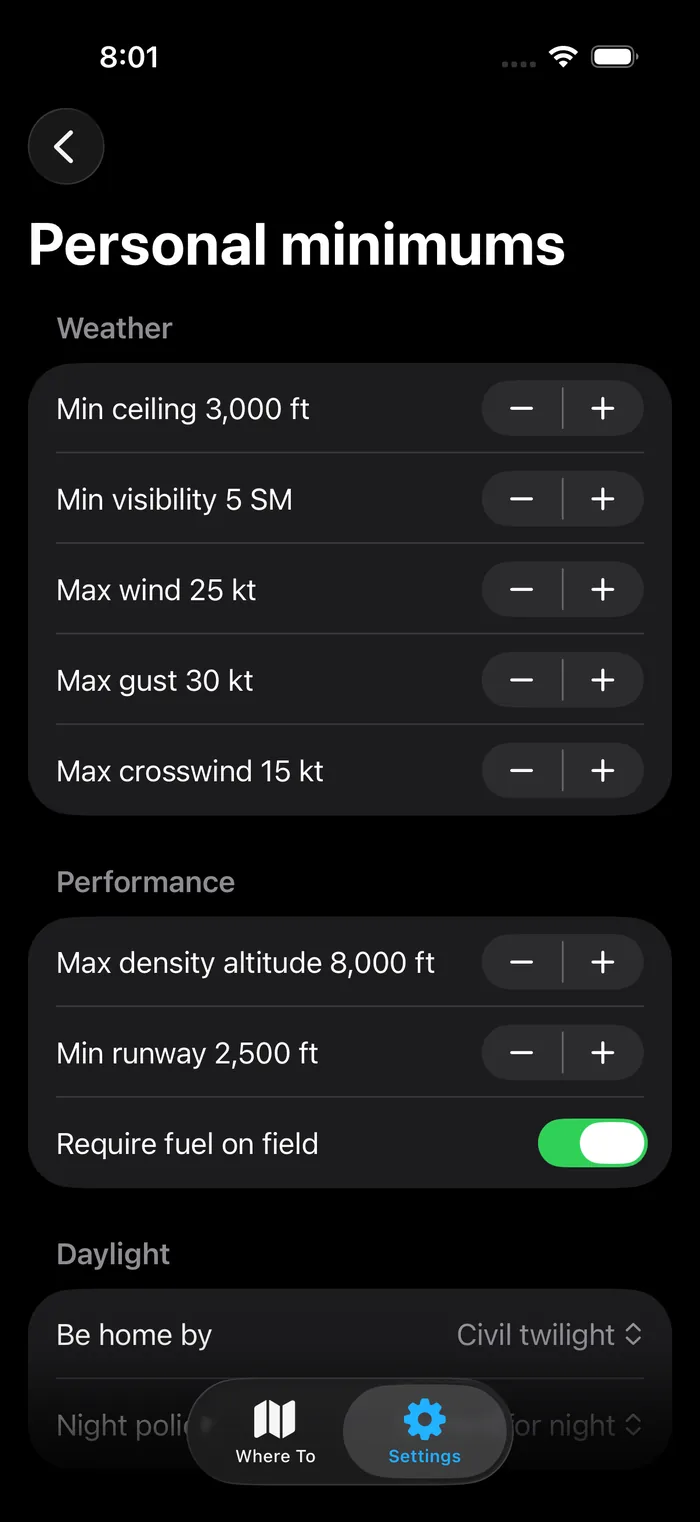
Set your airplane and your limits
Your cruise numbers, fuel, and personal minimums become the rules the map is scored against — not a generic VFR line.
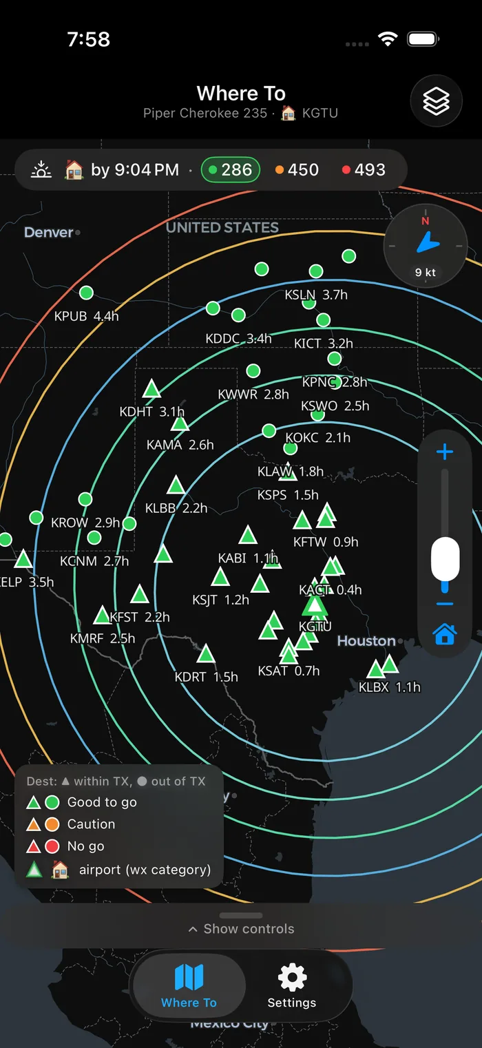
See every field scored
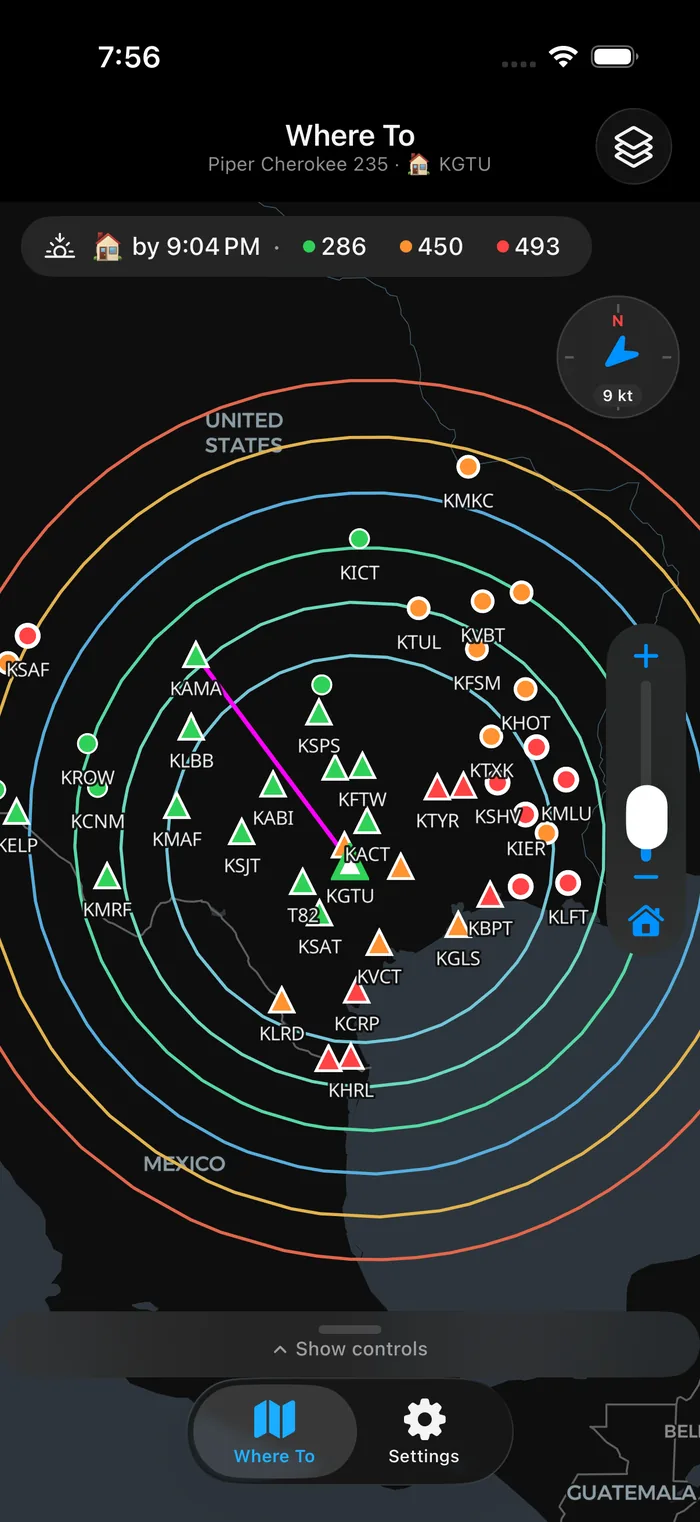
Wind-shaped range rings and a GO / CAUTION / NO-GO dot for every reachable airport — each labeled with how long it takes to get there.
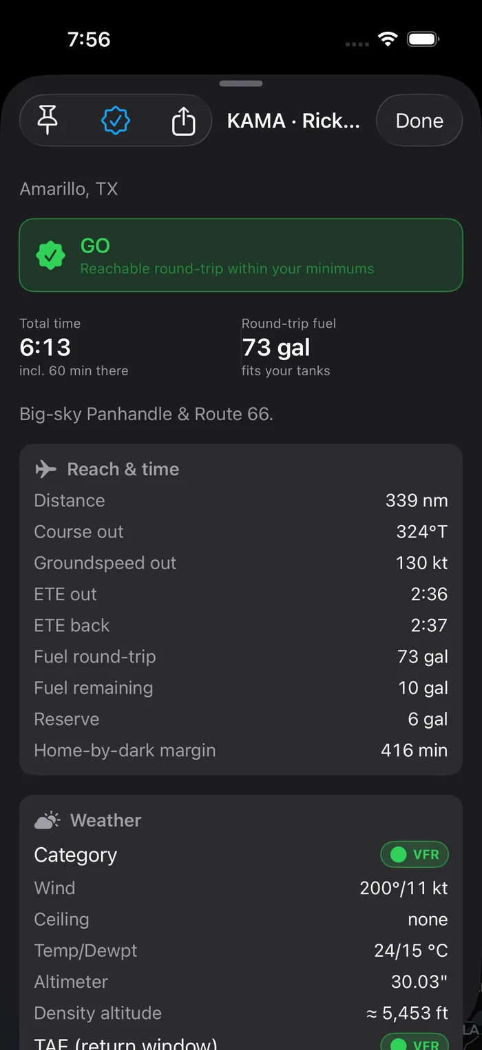
Open one — or share it
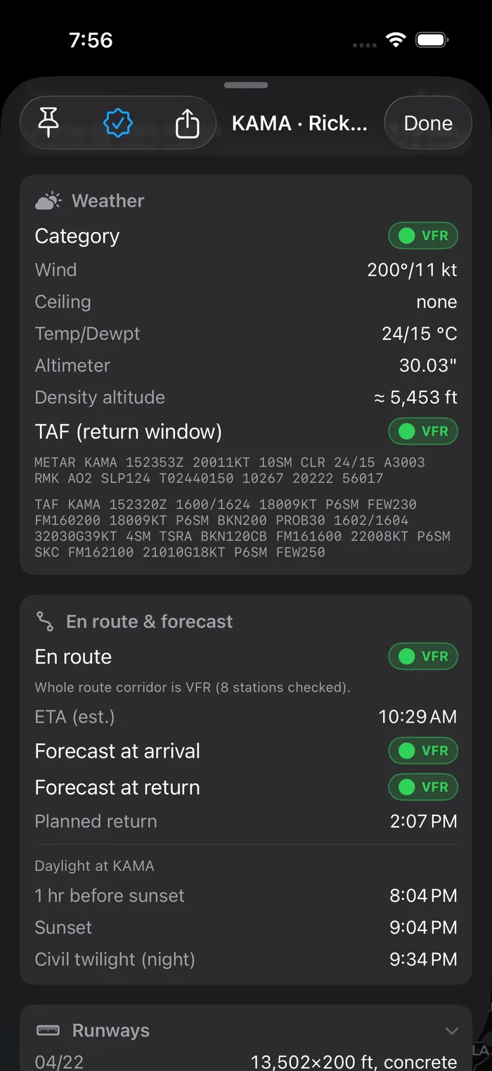
Tap a field for the whole picture: weather, route, fuel, runways. Then text the one-page plan card to your right-seater.
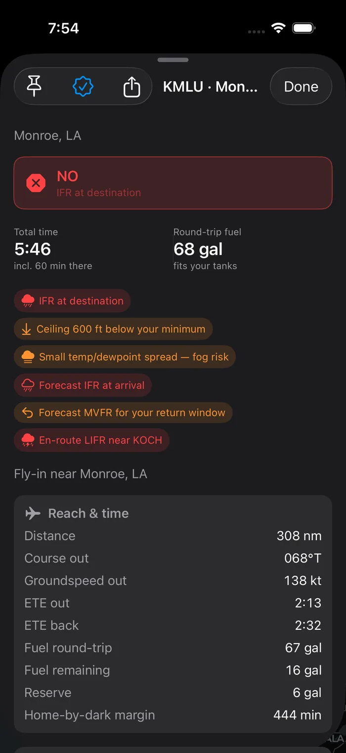
It does the planning math — and shows its work.
A go/no-go that tells you why.
Every field gets a plain-English verdict and the reasons behind it — read against the minimums you set, not a one-size line. No mystery, no false confidence.
- “Ceiling 600 ft below your minimum,” “fog risk,” “forecast IFR at arrival.”
- Round-trip fuel checked against your tanks and reserves.
- When a leg won't fit the tank, a fuel stop is suggested — a public field with 100LL, roughly midway, VFR, within a course-deviation limit you set, with the detour and stop time counted against your daylight.
- GO, CAUTION, or NO — colored the way a cockpit would.
Not just the endpoints. The middle, too.
Flybound scores a corridor along your route using the forecast for the time you'll actually pass through — so “destination VFR, but IFR across the middle” stops being a surprise at the halfway point.
- Worst-case conditions in the corridor, called out by station.
- Forecast at your arrival and your return window.
- An honest “whole route is VFR” when it is.
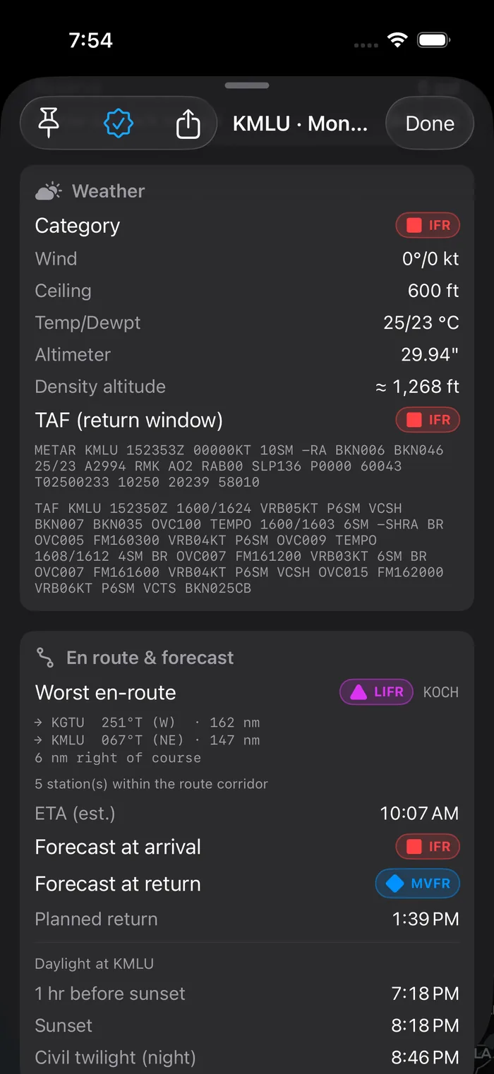
It knows the difference between dark and legal.
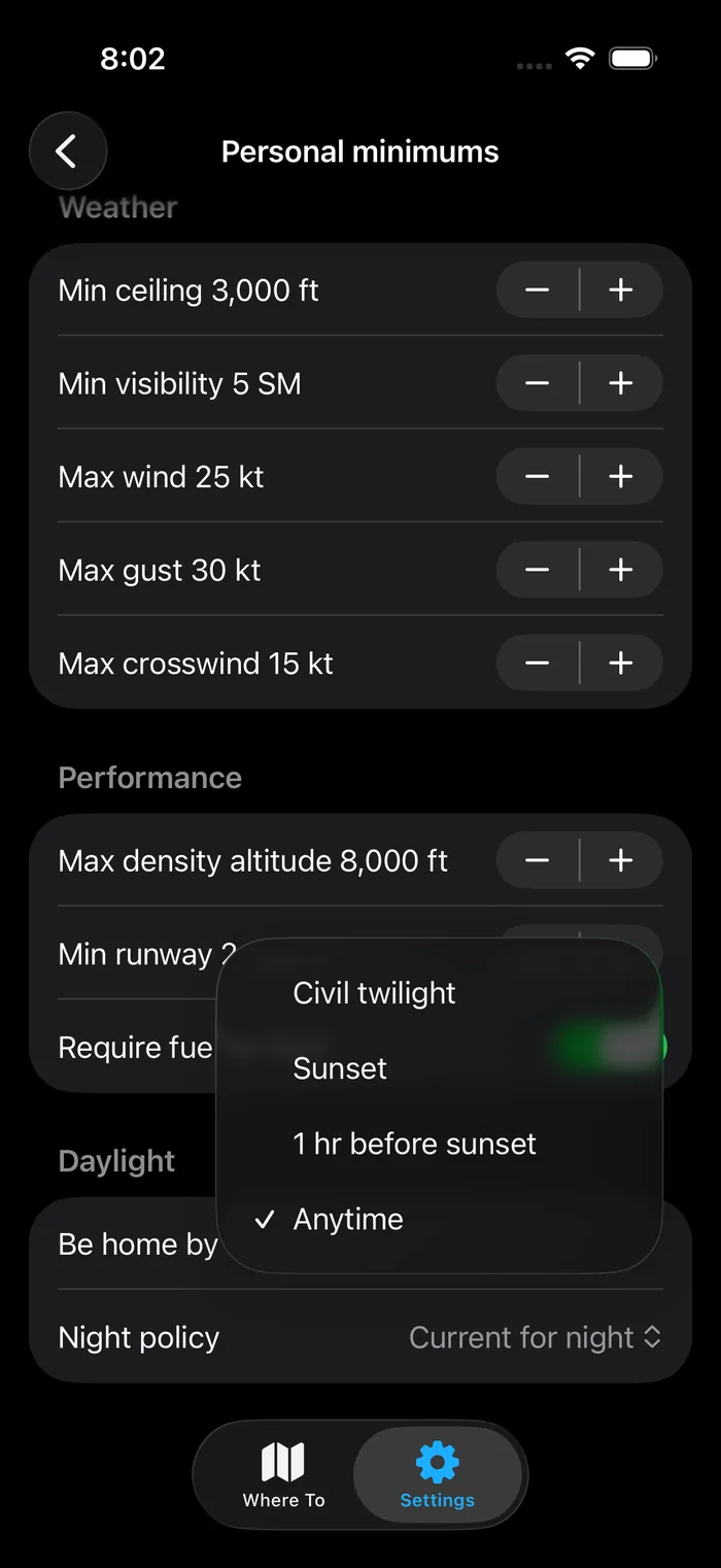
Tell Flybound how you fly after sunset — avoid night, fly only when current, or allow it — and it checks each leg against your choice. When a return lands in FAR night, it flags the §61.57 passenger-currency trap before you commit.
- Be-home-by: civil twilight, sunset, an hour before — or anytime.
- Per-leg night detection, out and back.
- A §61.57 cue — a prompt to check your own currency.
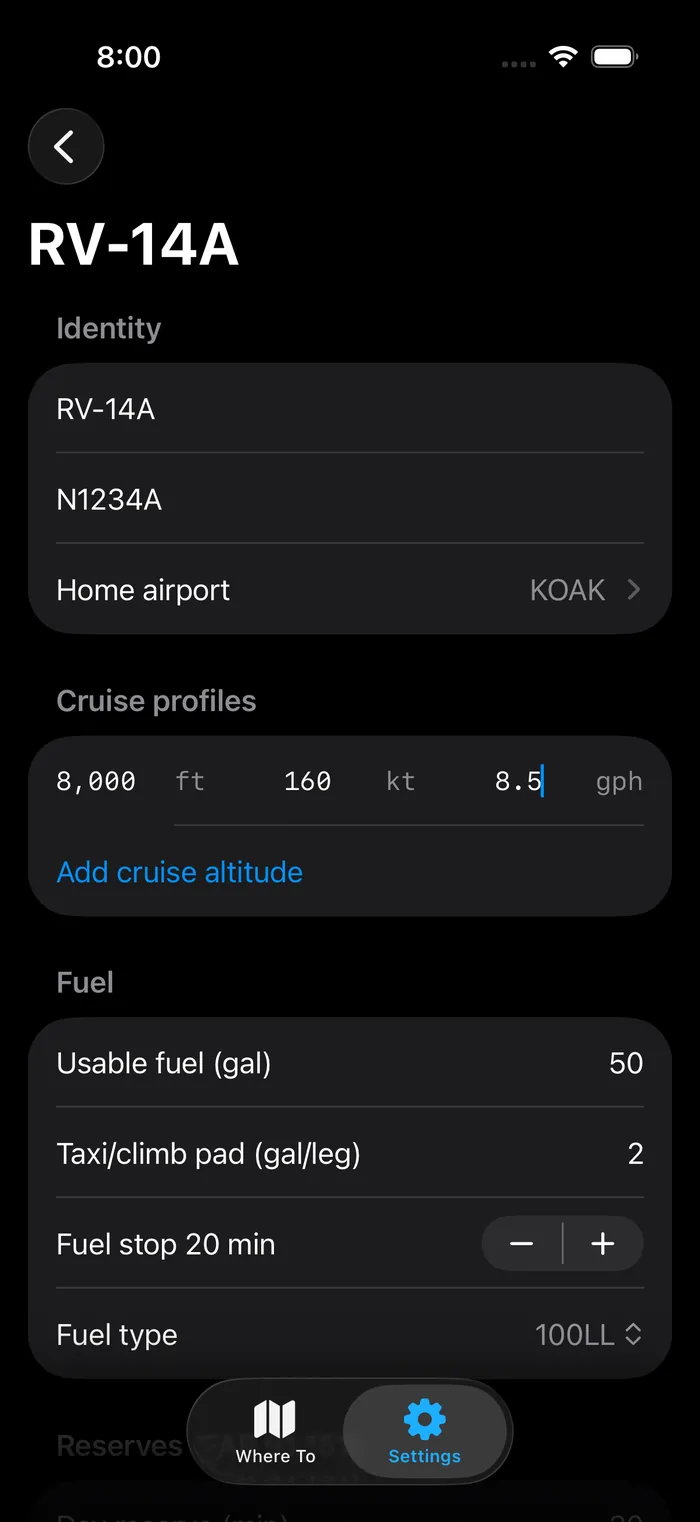
The numbers match what you actually fly.
Build a profile per airframe: cruise speeds by altitude, usable fuel, taxi and climb pad, day and night reserves to FAR 91.151. Switch aircraft and the whole map re-scores.
- Multiple cruise altitudes, each with its own speed and burn.
- Separate day and night fuel reserves.
- Optional POH ground-roll numbers with a safety factor.
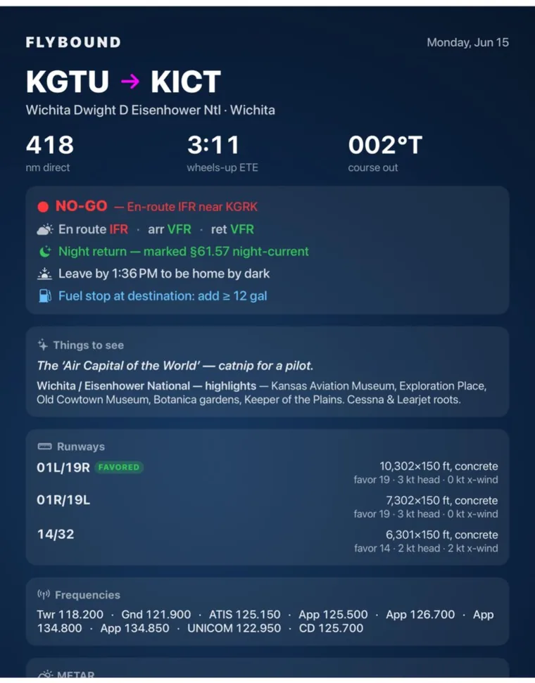
One card. Straight to the group thread.
Tap share and Flybound builds a clean, one-page briefing card: the route and decision, per-segment weather, the night-return note, any fuel stop, favored runways, frequencies, and the raw METAR. Ready to text.
- “En route VFR · arr VFR · ret MVFR,” tinted per segment.
- Grows to fit — dense fields never get clipped.
Read the sky at a glance
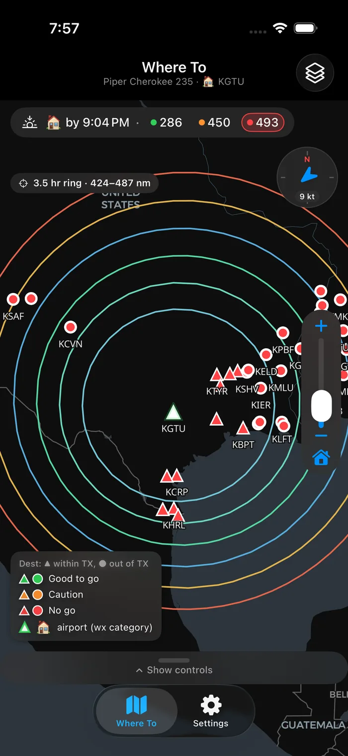
Rings are time bands — tap one for its distance. Colors are the decision. The flashing triangle is home.
Leave time & winds
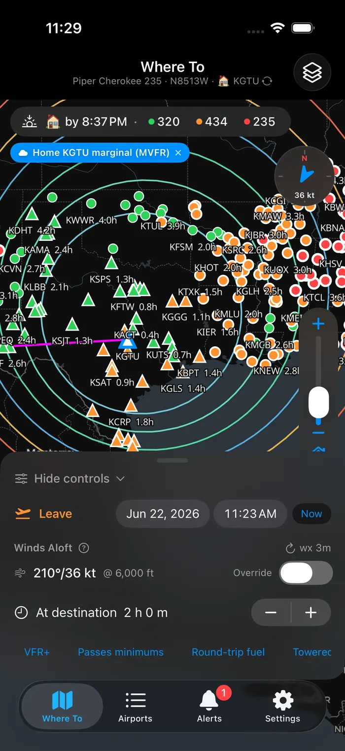
Pick a departure out to 48 hours. NOAA winds aloft shape the rings per leg. Filter to just the fields that pass.
Every field, in a list
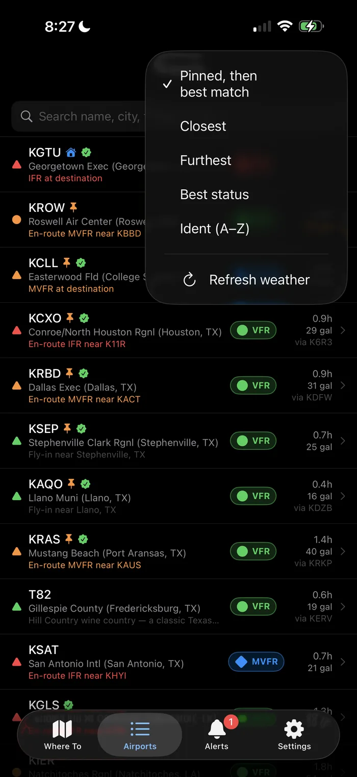
A dedicated Airports tab: search by name, city or what's nearby, and sort by pinned, closest, furthest, best status or ident. Tap a pin on the map to jump straight to that field's full briefing.
Scout alerts & inbox
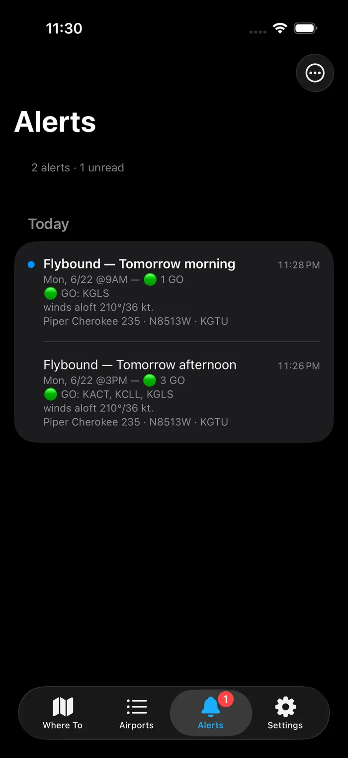
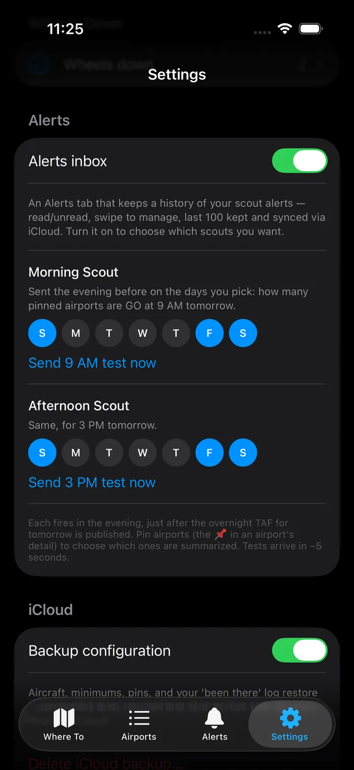
An evening-before heads-up, on the days you pick, when your pinned fields look GO tomorrow morning or afternoon. Every alert lands in a full inbox — history, read / unread, swipe to manage, iCloud-synced across your devices.
A passport of fields flown
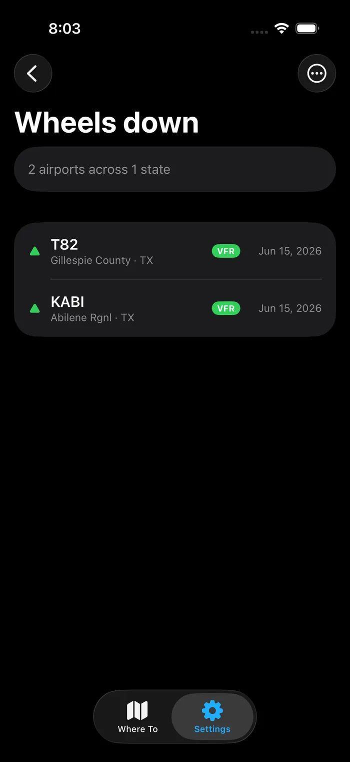
Mark a field wheels-down and it joins your log — a running record of everywhere you've put it on the ground. Pin the ones you keep coming back to, and export or import the whole list — visited and pinned — as a plain CSV.
A complete field briefing
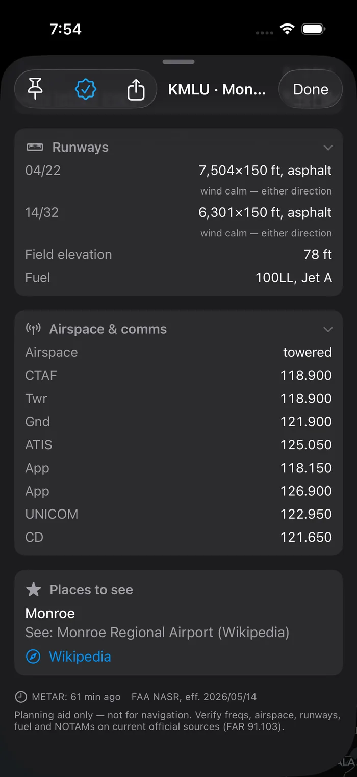
Runways with crosswind and density altitude, frequencies, fuel, places to see — and the FAR 91.103 reminder.
4,500+ US public airports
Public-use fields from official FAA data, refreshed each cycle — real coverage, not a hand-picked shortlist. Another 7,500+ private fields are a filter tap away, left out of the day-trip scan by default.
The app, screen by screen.
Free to fly with.
The core map is genuinely useful on its own — and free for good. Pro unlocks the rest, monthly or once for life.
- GO / CAUTION / NO-GO for every reachable field within 2.5 hours
- Simple filtering — GO / CAUTION / NO-GO
- One aircraft + home-airport pair
- Up to 10 Wheels-Down fields
- Up to 50 airports shown at a time
- 1-hour stay at the destination
- Weather refresh fixed at 15 min
- Persistent iCloud sync — settings, aircraft, Wheels-Down
- No scout alerts or inbox · no import / export
- Multiple planes & home airports — instant toggle
- User-definable max distance ring — out to 6.5 hours
- More than 50 airports shown at a time — up to 200, or all in range
- Add extra time at your destination — built into the daylight, return-by & fuel math
- Advanced filtering — VFR+, personal minimums, towered, paved / unpaved, public / private, new-to-me & visited, enough fuel & more
- Scout alerts + a full Alerts inbox — history, read / unread, iCloud-synced
- Configurable weather refresh — 5 to 30 min
- Shareable in-flight detail card
- Unlimited Wheels-Down — with import / export
- Everything in Pro — forever
- One payment, no subscription
- All future Pro features included
The core scored map is free. Pro is $14.99/month after a 14-day free trial — or $59.99 once for Lifetime.
The honest answers.
Is Flybound an EFB?
Does it replace a weather briefing?
Where does the data come from?
What aircraft does it support?
Does it handle night flying?
How much does it cost, and what platforms?
It's a flying day. Go look.
Download Flybound and get the first hour of your flying weekend back.
Download on the App Store

Planning aid — not for navigation. FAR 91.103 still applies.